Reflections on The Digital Image of the City: Hartford 2015
As the new semester is upon us–how did that happen so quickly?–I wanted to reflect back on my courses from last semester. I had a beautiful first semester at Trinity College, thanks mostly to those incredible faculty, staff, and students with whom I spend my days.
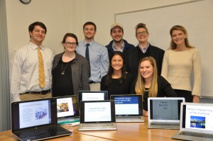
My senior seminar, The Digital Image of the City, which was a huge success–or so said the students on the final day, all smiley as they were on the last day (and as you can see on the image in the left)! I share a short explanation about the Community Learning Initiative course, describe the in-the-field and critical GIS research methods students used and applied, and then share their final presentations for apps, websites, or technological infrastructure to improve the City of Hartford for the common good. I also share the Trinity College Communications write-up regarding the course–thanks to them we also have this swell photo of us well!
What was this course about? As over half the world’s population now dwells in cities, revolutionary advances in technology such as big data have caused policymakers and activists alike to focus on the promise of smart urbanism. Smart urbanism claims to use technology and data to intervene in urban issues ranging from gentrification and pollution to access to public spaces and improved walkability. With this in mind, we asked the following questions: How does this new focus support or inhibit the growth of equal and just cities? And how can we use data and data visualizations to represent the cultural experiences of the city in ways that affect public policy for the common good? My goal was to connect students to the everyday life of the city for very different groups of people and their goals, all the while emboldening them with social scientific research methods training in order to show them how their insights and research generally can make social change possible. As the smart cities craze grows, it’s key to have young people learn the tools and debates in those conversations and be key contributors to that work.
The Digital Image of the City was part of Trinity’s Community Learning Initiative (CLI), a focused and collaborative effort with city activists, artists, leaders, and civil leaders. My students and I partnered with Jennifer Cassidy who is resident of Asylum Hill and long-time activist with and leader in the Asylum Hill Neighborhood Association (AHNA). Jennifer generously toured us through Asylum Hill while sharing the rich social and political history and current issues facing the neighborhood and the City of Hartford. Students also attended an AHNA neighborhood meeting.
At the same time, students received Trinity College Institutional Review Board (IRB) training and conducted their own research by interviewing city residents and commuters. We decided to include both since Hartford doubles in population each weekday. Students each gathered a total of six mental maps and used the insights from these maps and the accompanying interviews to choose a focus for their final research paper and GIS maps. Students learned the free and open-source software QGIS using the utterly awesome Frank Donnelly’s (GIS librarian, CUNY Baruch College) QGIS practicum which is also free and open to the public. As for datasets, half of the students relied on Hartford Open Data or compiled their own geodatasets of a set of locations of interest. They used this research, along with readings from the class and their own academic and media literature reviews, to craft recommendations for apps, websites, or technological infrastructure to improve the city for the common good. The presentations below are the final outcomes of the eight seniors’ research in The Digital Image of the City in the fall of 2015 at Trinity College, and you can read the papers here. Thanks again to the Trinity College Communications for putting together a short piece on my course, and sharing our final presentation day.